
Breathing Polder
A Reclaiming Landscape
Course: Studio Regional Design
Institution: Wageningen University & Research
Scale: Regional system
Date: May 2026
The Reclaiming Landscape presents a future vision for the Wieringermeer, in which water is no longer approached as a condition to control, but as an active driver for shaping agricultural land. Developed as part of the course Studio Regional Design, the project explores how water-led approaches can inform the transition towards a climate-robust and productive landscape.
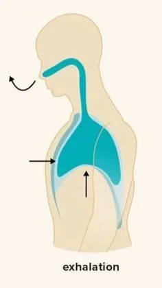
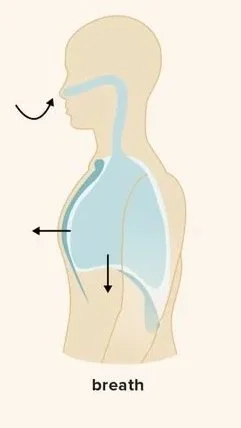
Approaching the water system from an ecological and a resilient point of view, the project introduces a spatial strategy in which controlled submersion, ecological gradients, and adaptive agricultural practices are integrated. This results in a “breathing” landscape, where water levels fluctuate over time, supporting both ecological processes and agricultural production.
By shifting from a reclaimed to a reclaiming landscape, the project demonstrates how water, ecology, and agriculture can operate as one system, turning challenges such as salinization and water surplus into drivers for spatial design.
Regional Strategy
buffer, protect, & accept
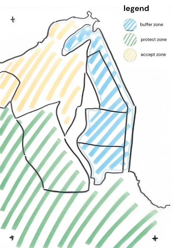
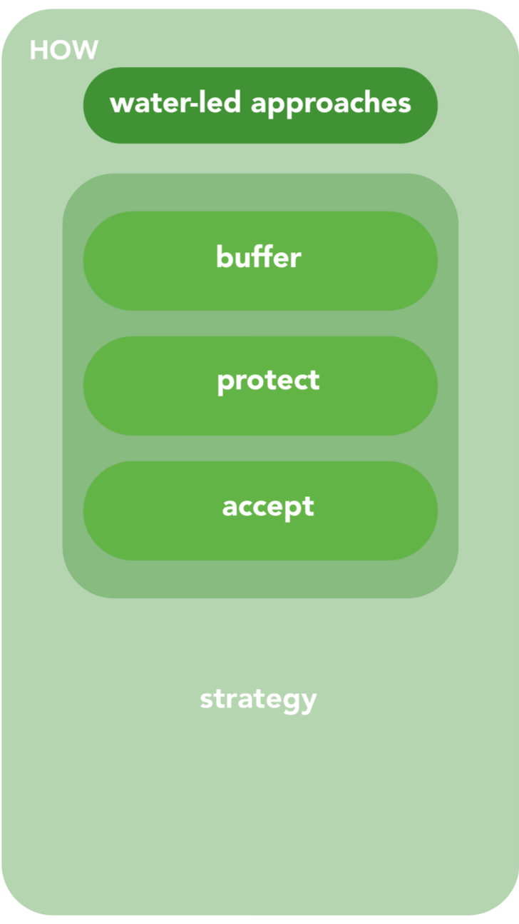
The water-led approaches of buffer, protect, and accept are translated into the Wieringermeer based on an analysis of salinization intrusion, elevation differences, and fresh water demand.
Areas most vulnerable to salinization and are in close proximity to the Waddenzee are approached through acceptance, allowing saline seepage to shape the landscape. In zones where agricultural productivity and fresh water demand remain high, protection is prioritized to maintain stable growing conditions. Between these extremes, buffer zones are introduced to regulate water flows, store excess fresh water, and reduce pressure on surrounding systems.
In this way, the IJsselmeer and Wadden Sea are no longer treated as boundaries, but as extensions of the system, allowing water to actively structure the land.
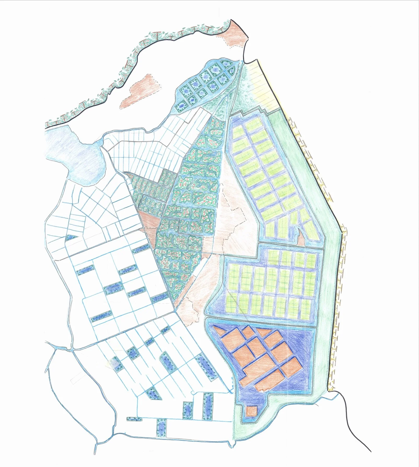
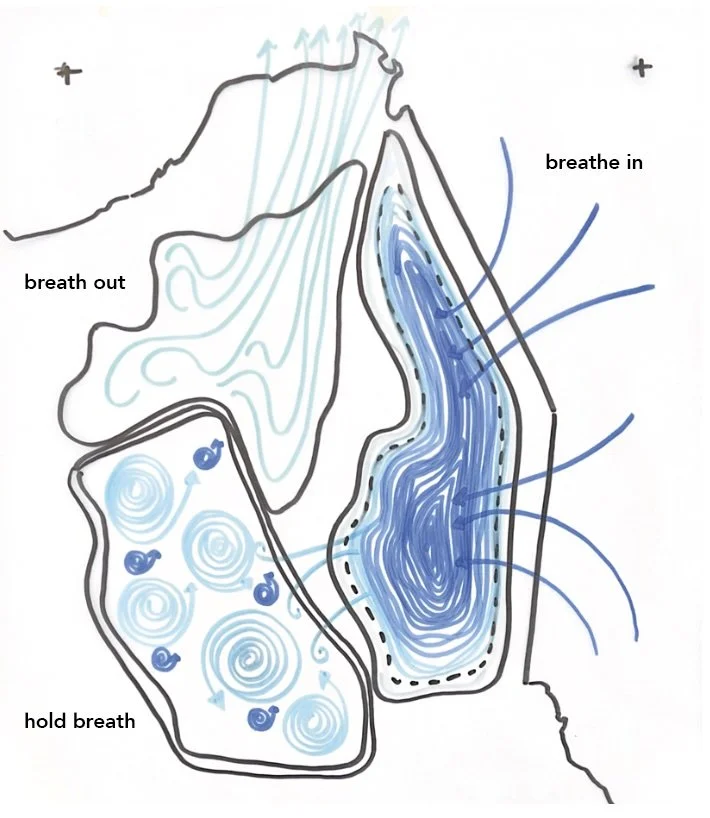
the breathing polder
Operational Logic
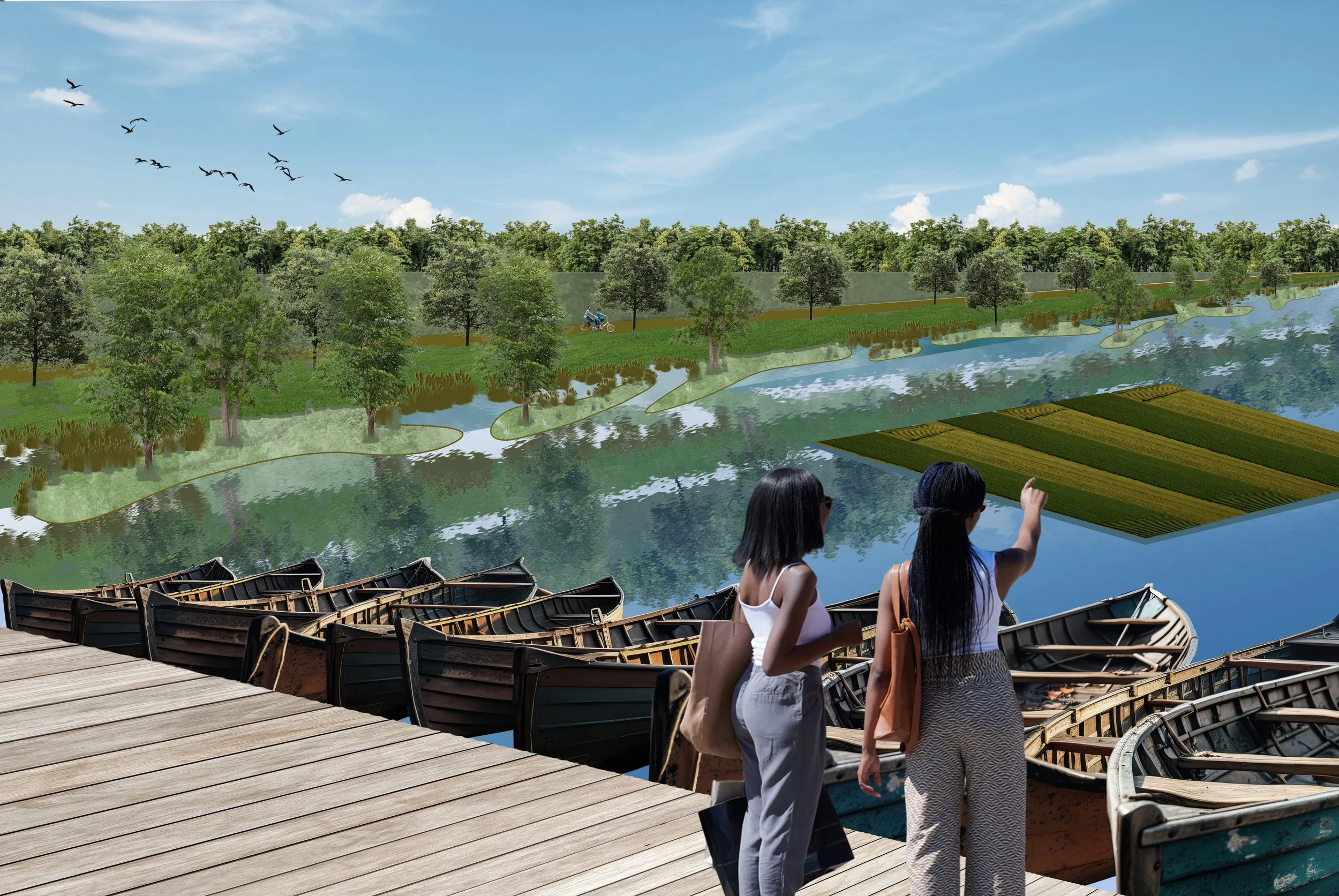
Using the East side of the Wieringerpolder as a buffer zone, where fresh water is stored, the water system will gradually transition from rigid control towards adaptive coexistence. In this area, water and land are constantly negotiating their relationship.
Through a system of interconnected buffer basins linked to the IJsselmeer, the landscape operates as a breathing structure: expanding during periods of water surplus (winter) and contracting in times of scarcity (summer), when water is used to irrigate crops.
These “lungs” regulate water levels, salinity, and productivity across the region, transforming flood risk and saline intrusion into active design drivers. Agricultural practices, ecological systems, and water infrastructures are organised into a layered, productive landscape that evolves over time.
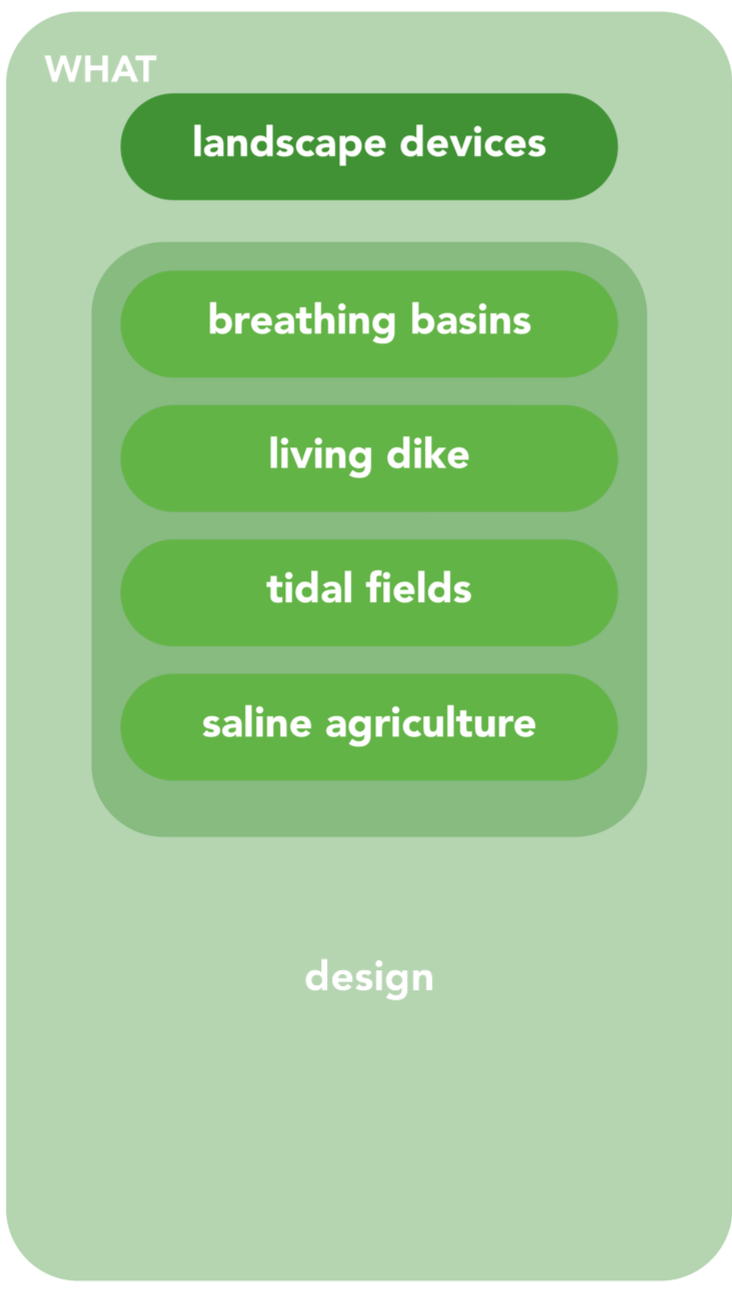
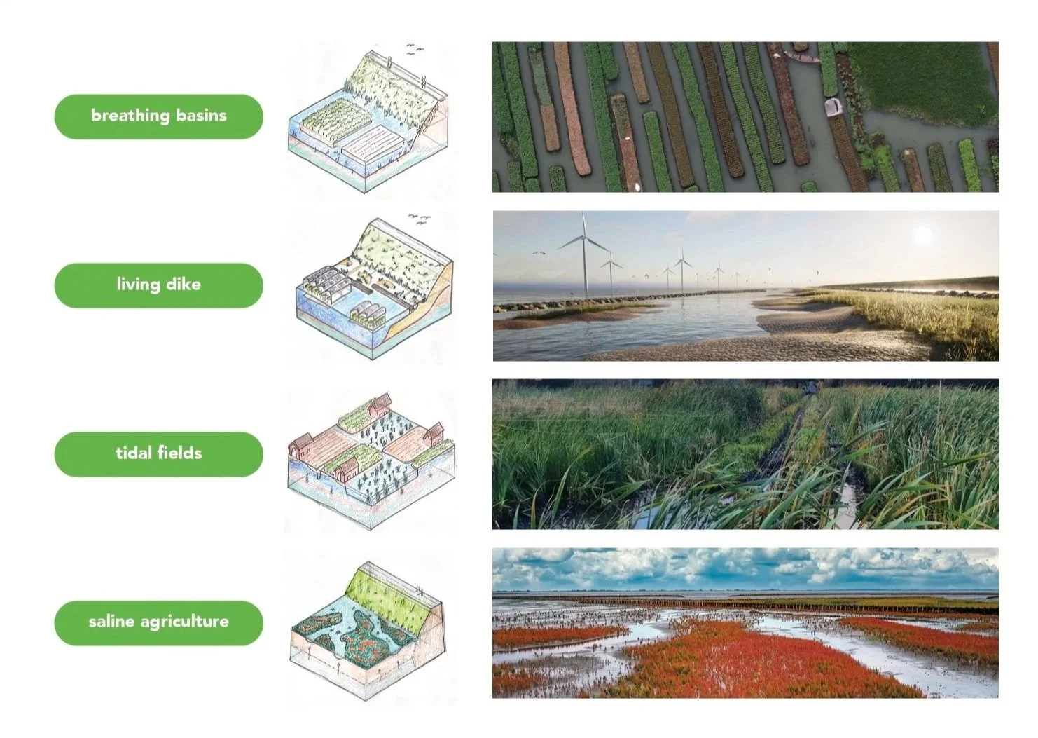
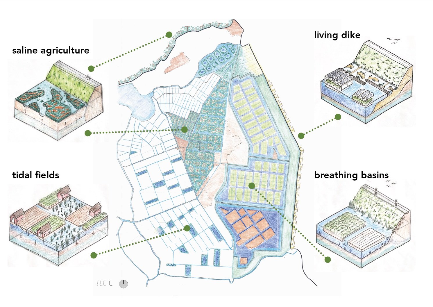
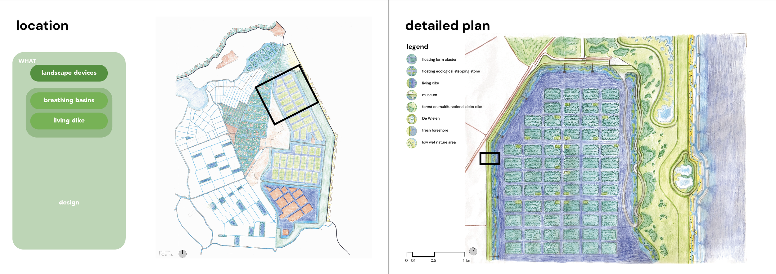
A total of four landscape devices are proposed to work towards a future-proof agricultural landscape.
The breathing basins function as dynamic buffer systems connected to the IJsselmeer, within which floating farms and aquatic food forests are integrated as productive layers. The living dike is composed of foreshores and ecological slopes, which filter water while also offering space for recreation. Tidal fields accommodate floodable agricultural parcels that respond to seasonal water fluctuations. Saline agriculture fields consist of salt-tolerant crops and experimental fields that evolve over time.
Together, these landscape devices form a coherent system that organizes the flows of water, salinity, nutrients, crops, and animals across the region. While each device operates with its own logic, they are interdependent and function as an interconnected landscape system. In this way, localized interventions contribute to a scalable strategy for a future-proof agricultural landscape.

FULL DOCUMENTS

The management report of Wieringemeer shows how a regional strategy of waterled approaches has the opportunity to create synergies between agricultural transitions and a climate robust future.